Today, the haze is invisible to the eye; only the smell of diluted smoke reminds me that it’s still somewhere around. After days, or maybe even weeks, the landscape is visible again as we drive along the Pan Borneo Highway. The sun just set; there are not a lot of cars on the road. I feel drowsy. Sleepy conversations take place. We drive by a small town called Siniawan, which is famous for its weekend market, country music festival, and Chinese New Year festivities. The moment we get closer to the Bau town area, beautiful sights of a karst landscape appear on the horizon. Until today, I always thought that these kind of landscapes could only be found in Guilin, China.
It turns out Sarawak also has it.
According to the Sarawak Tribune, the Bau Limestone formation was formed during the late Jurassic to Early Cretaceous, around 163 to 100 million years ago. The formation of this limestone resulted from deposition in a shallow marine environment with warm ocean currents far from land remains. This process involved the accumulation of shells, corals, and fragments of marine life, as well as the precipitation of calcium carbonate from seawater, forming the sedimentary rock known as limestone. People travel to Bau to visit the “Fairy Cave,” “Wind cave,” and “Paku Rock Maze garden,” which are part of the Sarawak Delta Geopark.
A welcome sign greets us as we enter Pekan Bau, and we drive toward the town to have breakfast. The guy with the dark eyes tells me about the origin of the town’s name. I later find multiple stories that mention that It was inspired by Bau’s Gunung Krian, also known as “Maw San” by the Chinese, which translates to Hat mountain. In the past, Chinese folks adapted the name of the mountain and called the old town “Maw San.” Over time, due to linguistic adaptation and translation to Malay, “Maw,” changed to “Bau.” Another story I read states that the Bidayuh tribe referred to their settlement as “kapok baau,” which means “new village,” in their language. To distinguish it from their own kampungs, Baau eventually became Bau.
As most of the stories I have been hearing or reading, different sources will give you different stories.
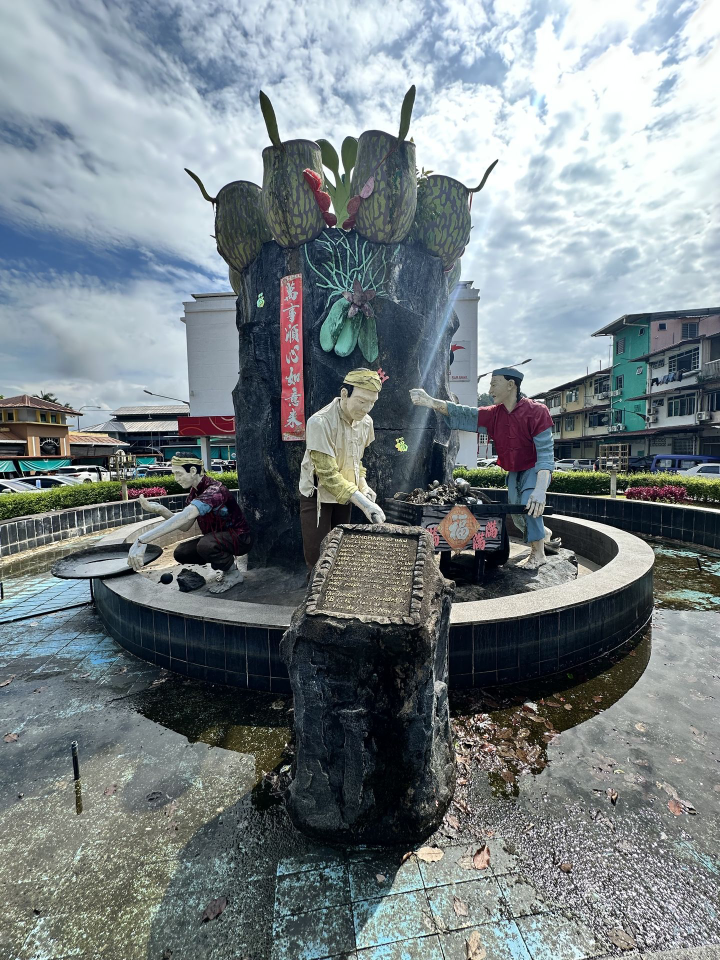
We park the car near the gold miners’ statue, which is located next to a roundabout beside the food hall where we have breakfast. The statue portrays a 19th-century gold miner holding a shovel, looking forward resiliently. It was built to commemorate Bau’s heritage as the historic “Gold Town of Sarawak.” The statue honors the early Hakka Chinese immigrants who arrived in the Old Bau area during the 1820s and 1840s, organizing mining cooperatives to extract gold and antimony.
While waiting for our food, three other friends join, and I walk around the wet market. Here, people buy fresh vegetables and fruits and local bakery treats such as Kueh and curry puffs, to name a few. People have small talk, a woman sits on the tiles waiting for customers, and cats are playing with each other’s tails. This is also the place where I found the biggest banana ever (a Pisang Tanduk). After we finish our breakfast, we head to the car, passing by color concrete buildings while taking pictures of Gunung Krian, which is quietely, but proudly overseeing this golden town.
Thank you for reading Borneo Stories! The best adventures aren't done alone. I’m actively seeking collaborators, locals, and partners who want to showcase the authentic beauty of Borneo together. If you have a unique perspective, feedback or a location to share, I'd love to connect.
borneodavid@outlook.com